DREAMS Laboratory
The Distributed Robotic Exploration and Mapping Systems (DREAMS) Laboratory specializes in the research and development of autonomous robotic systems and cyber-physical twins, for advanced mapping, sampling, and analysis in diverse environments — terrestrial, aquatic, and extraterrestrial.
As part of Arizona State University, the DREAMS Lab is affiliated with the School of Earth and Space Exploration, the Global Futures Laboratory, and the Center for Global Discovery and Conservation Science (GDCS). Located in the heart of innovation at ASU's Walton Center for Planetary Health (WCPH), the lab welcomes everyone interested in pioneering research and scholarship.
Courses
SES 598: Space Robotics and AI
Spring 2026 | Tu/Th 1:30-2:45pm | ASU Tempe Campus, Room PSF501
This course provides a comprehensive introduction to robotic exploration and AI-driven mapping and sampling techniques, tailored for space exploration and earth observation. Students will gain expertise in key areas such as computer vision, Simultaneous Localization and Mapping (SLAM), multi-robot coordination, and operations in extreme environments. The curriculum emphasizes a strong theoretical foundation leading up to real-world implementation, combining lectures with hands-on projects using mobility autonomy systems, including autonomous ground, aerial, and aquatic robots available as digital twins and physically in the DREAMS Laboratory. The course culminates in a group-based final project, where students design and demonstrate end-to-end robotic systems for space exploration, planetary science, and earth observation.
View Course Details →Focus Areas
Terrestrial
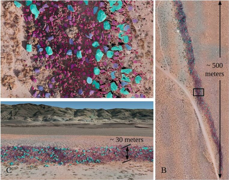
Projects span geomorphology, drylands ecology, and precision agriculture. Systems and algorithms operate as a network of autonomous ground and aerial vehicles, and ground based static sensors, enabled by cyber-physical twins.
Projects
QuAD-FLIP: Quadrotor Aerial Delivery with Flipping for Limited-access Inspection and Probing
Aquatic
Robotic boats and autonomous underwater vehicles for limnological, littoral, and coastal mapping and sampling of the water column, and the benthos.
Projects
Collaborative Robotic Aquatic Laboratory (CoRAL)
Cyber-Physical Twins
Digital and Physical twins leveraging cyber-physical systems, for simulation studies, dynamical analysis, and predictive modeling of environmental processes.
Projects
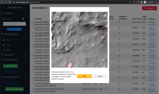
DeepGIS decision support system
Virtual Shake Robot and ShakeBot
Planetary
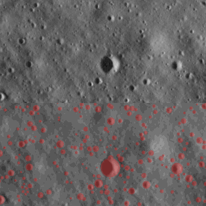
Surface feature mapping, vision systems, and digital twins, with focus on Mars and Moon.
Projects
Sub-centimeter Resolution Lunar Digital Twin for Collaborative and Immersive Mission Planning (NASA STTR)
People
| Photo | Name | Position | Affiliation |
|---|---|---|---|
|
|
Jnaneshwar Das | Faculty | ASU School of Earth and Space Exploration |

|
Rodney Staggers Jr. | Ph.D. student | ASU School of Earth and Space Exploration |

|
Zhiang Chen | Affiliate Postdoctoral Scholar | California Institute of Technology |
|
|
Deep Rodge | Perception Research Aide | ASU Fulton Schools of Engineering |
|
|
Akshay Mahalle | Computational Geomorphology Research Aide | ASU Fulton Schools of Engineering |
|
|
Yi-Hau Lai | Robotics and Perception Research Aide | ASU Fulton Schools of Engineering |
|
|
Andrea Schoonover | Research Volunteer | ASU Fulton Schools of Engineering |

|
Saransh Jain | Affiliate Researcher | Argonne National Laboratory |
|
|
Pavan Kalyan Majjiga | Research Volunteer | ASU Fulton Schools of Engineering |

|
Kanav Prashar | Field Robotics Research Aide | ASU Fulton Schools of Engineering |
|
|
Test Operator | None | None |
Assets
| Name | Description | Photo | Project |
|---|---|---|---|
| R/V Karin Valentine (robotic boat) | R/V Karin Valentine is an autonomous surface vehicle (ASV) or a robotic boat, capable of water column sampling, bathymetric mapping, and physical sample return from water bodies such as lakes and marinas. |
|
Collaborative Robotic Aquatic Laboratory (CoRAL) |
| uDrone autonomous underwater vehicle (AUV) | uDrone is a quadrotor format agile autonomous underwater vehicle (AUV), designed for operating solo, or in tandem with R/V Karin Valentine autonomous surface vehicle (ASV), that serves as a base ship for heterogeneous operations. uDrone has been designed for persistent coral reef monitoring and geological bathymetric mapping. |
|
Collaborative Robotic Aquatic Laboratory (CoRAL) |
| Rocky II hexrotor drone | Rocky II is a hexrotor drone for searching and mapping of fragile geologic features such as precariously balanced rocks. Rocky II has also been used for multi-spectral imaging for rocky fault scarps. |
|
Terrestrial Robotic Observing Network (TRON) |
| EarthPod Sensor Probe | Designed to operate solo or as a sensor network, EarthPod is a sensor probe that can do weather and soil parameter sampling for time series studies, EarthPod when networked, can help do optimal interpolation of scalar fields such as temperature, for environmental monitoring. |
|
Terrestrial Robotic Observing Network (TRON) |
| High-altitude balloon payload | Lightweight, low SWaP (< 1.5 kg) high-altitude balloon payload for aerobiological sampling. The innovation incorporates the latest drone flight control technologies and custom environmental sensing hardware. A ground-tested prototype for the payload has been designed |
|
High-altitude balloon payload with attitude control and predictive scheduling, for environmental monitoring |
| EarthRover | 26” Schwinn adult tricycle frame, augmented with a front electric motor for traction, a steering system, rear aerodynamic solar panel assembly, a rear mast for avionics, sensing, and compute payloads. The vehicle’s large (26”) wheels and low weight (65 kg), enables stability and long range (up to 50 km a day with solar), and is capable of GPS-enabled vision based autonomous navigation on paved or unpaved paths. The vehicle can execute repeatable paths that are either learned by the system from experimental drives by a rider, or through specified or optimized mission plans. |
|
EarthRover: Affordable and Sustainable Mobility Autonomy for 4D Environmental Monitoring |
| Flippy quadrotor drone | Lightweight and agile quadrotor drone with 45cm diameter, with onboard gripper and ARM compute, capable of acrobatic maneuvers. |
|
QuAD-FLIP: Quadrotor Aerial Delivery with Flipping for Limited-access Inspection and Probing |
| MAVROS Vehicle | Robotic boat for autonomous water surveys |
|
MAVROS Data Collection |
Publications
(2024) Quantifying and analysing rock trait distributions of rocky fault scarps using deep learning Access
(2024) Virtual Shake Robot: Simulating Dynamics of Precariously Balanced Rocks for Overturning and Large-displacement Processes Access
(2023) A Survey of Decision-Theoretic Approaches for Robotic Environmental Monitoring Access
(2021) Terrain-Relative Diver Following with Autonomous Underwater Vehicle for Coral Reef Mapping Access
(2021) OpenUAV Cloud Testbed: a Collaborative Design Studio for Field Robotics Access
(2020) Geomorphological Analysis Using Unpiloted Aircraft Systems, Structure from Motion, and Deep Learning Access
(2018) Robust Fruit Counting: Combining Deep Learning, Tracking, and Structure from Motion Access
(2017) Counting Apples and Oranges With Deep Learning: A Data-Driven Approach Access
(2015) Data-driven robotic sampling for marine ecosystem monitoring Access
(2015) Devices, systems, and methods for automated monitoring enabling precision agriculture Access
(2012) Coordinated sampling of dynamic oceanographic features with underwater vehicles and drifters Access
(1) Google Scholar Access
Acknowledgements


